
The Agreements of Nettuno and Belgrade
Italy and the Kingdom of SHS regulated border traffic gradually — initially only through temporary checkpoints. The first permanent arrangement came on 27 January 1924 with the Belgrade Agreement, which divided the territory of the Free State of Fiume. On 20 July 1925 the two countries signed the Nettuno Conventions, which precisely defined border traffic, the rear border zone and the border tourist zone. With this, the border zone on both sides became a formally regulated frontier, with clearly defined rights and restrictions for the local population.
The Rear Border Zones
The Nettuno Agreement defined a rear border zone on each side of the border — a geographical area whose inhabitants were entitled to cross the border at lower-category crossings using a frontier card. The zones were delimited point by point along the entire border line from Peč to the Adriatic.
Italian rear border zone
The zone covered the area from Peč to Pungrat (Cima Ruter) and included: Bela Peč (Fusine in Valromana), Mangartska jezera, Rif. Sillani at Mangartsko sedlo, Rif. Suvich in Loška Koritnica, Jalovec, the alpine pastures of Zadnja Trenta, the source of the Soča, the Vršič road to the hamlet of Na Logu, the valley of Zadnjica, the saddle between Prehodavci and Zadnjiški Ozebnik, the alpine pasture Za Skalo, Lanževica and the paths to Bogatinsko sedlo — on this stretch the zone extended only 500 metres into Italy.
From Bogatinsko sedlo to Rodica the zone ran parallel to the border and covered 300 metres of altitude below the ridge. From Rodica onwards: the path to Rut from Grahovo, paths to Stržišče, the railway station at Hudajužna, Durnik, Porezen, Poljane pri Cerknem, Škofije, Bevk, Sivka, Ledinsko Razpotje, the Gore–Tabor–Dole–Veharše–Godovič road, Godovič (along the old municipal boundary Hotedršica–Gorenji Logatec), Travni vrh, Cestar, the road towards Grčarevec, the old municipal boundary Planine–Ravbarkomanda along the Postojna–Planina road and the Postojna–Rakek railway, along the municipal boundary of Rakek to V. Javornik, the boundaries of the Windischgretz forest estate with Jurjeva dolina, Obramce, Kalvarija, Pravdenjak, the Financial Guard barracks at Cifri, Klanske police and Gomance.
Yugoslav rear border zone
The zone covered from Peč: Rateče, Podkoren, Kranjska Gora, Log in Gozd, Špik, Turkov rovt in the valley of Vrata, Rjavina, the path from Krma, the path to Vodnikova koča, Hribarice, Triglavska jezera, Korita — and like on the Italian side, 500 m from Bogatinsko sedlo and 300 altitudinal metres below the Tolmin–Bohinj ridge.
Further: the Bohinjska Bistrica railway station, Nemški Rovt, along the boundary of the cadastral municipality of Sorica to Podrošt, parallel along the boundary to Leskovica, Hotavelj, Sovodnje, Žiri, Osredek, Rovte, the Rovte–Logatec road, the Logatec railway station, along the railway to the Windischgretz estate, the Cerknica–Martinjak–Grahovo–Žirovnica–Lipsenj–Gorenje Jezero–Dane–Lož road, the road towards Grajševka, Požar to the present boundary with Croatia.
The Permit System
Every border crossing required a permit issued by the competent authority. The permit was tied to a specific crossing point — it was not possible to obtain a general permit to cross anywhere.
Competent authorities on the Italian side
Italy divided the border into seven sections with the following competent public security offices: Trbiž (Peč–V konec Špica), Tolmin (to Vogel), Podbrdo (to Hum pri Poreznu), Idrija (to Kalce), Postojna (Kalce–Lom pri Jurjevi dolini), the Rijeka questura (to Kastav) and Vološko-Opatija.
Competent authorities on the Yugoslav side
The Kingdom of SHS designated the following district offices for permits: Radovljica (Peč–Možic), Škofja Loka (to Sivka), Logatec (to Bele vode pri Leskovi dolini), Čabar (to Smrekovec), and the districts of Susak, Kastav and the police commissioner of Susak for the Rijeka section.
Single-crossing permit
Single-crossing permits, governed by Article 13 of the agreement, were issued on the Italian side by the public security offices or by the commander of the Financial Guard unit at Category 1 crossings. On the Yugoslav side the competent bodies were: the district office, the commander of the border police unit, the commander of the gendarmerie post, the frontier military officer or the commander of the Financial Control detachment.
Frontier card
Residents of the border zone were issued a frontier card (carte di frontiera), which allowed regular crossing at Category 2 crossings — equivalent to today's local border crossings. On the Italian side they were issued by the questure in Udine, Gorizia, Trieste and Rijeka; on the Yugoslav side by the districts of Radovljica, Škofja Loka, Čabar, Susak and Kastav.
Livestock and goods
Articles 5 and 6 of the agreement also regulated the crossing of livestock. Livestock could cross the border duty-free for the purpose of grazing on one's own land or wintering — owners were required to state the number, description and number of pregnant animals. Where there was no access to drinking water nearby, duty-free transport of water across Category 1, 2 or 3 crossings was permitted.
Six Categories of Border Crossings
From 1925 the temporary checkpoints were replaced by six official categories of border crossings — each with a precisely defined purpose, competent services and operating hours. Together there were nearly 200 between Peč and Gomance on the territory of present-day Slovenia.
Category 1 – International border crossings (Varchi e passaggi per il movimento generale)
General crossings without time restrictions, under the supervision of the carabinieri (with the Financial Guard in support). On Slovenian territory there were nine — seven road and two railway crossings.
Road crossings: Rateče · Petrovo Brdo · Podpleče pri Cerknem · Žiri (Osojnica) · Hotedršica · Gruden (Kalce) · Planina (main road)
Railway crossings: Ljubljana–Trbiž line (stations Rateče – Bela Peč) · Jesenice–Gorizia line (stations Bohinjska Bistrica – Podbrdo) · Ljubljana–Trieste line (stations Rakek – Postojna)
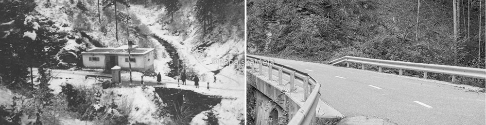


Category 2 – Local border crossings (Varchi per il movimento nella zona di frontiera)
Reserved for local residents holding a frontier card; under the supervision of the Finanzieri alone, without customs officers or carabinieri. Operating hours: 05:00–21:00 (from 04:00 in May and August, from 03:30 in June and July). Before the 1938 reform: 32 crossings on the territory of present-day Slovenia, 23 on the territory of present-day Croatia.
Rateče – Pri Jalnu 2/XXI-XXII · Vršič 6/XV-XVI · Vrh Bače 26 · Sorica – Petrovo Brdo 27/XXXIX · Rovtar – Petrovo Brdo 28/VI-VII · Podprvič 30/LII · Podlanišče 35/LX-LXI · Nova Oslica – Veharšče 36/I-II · Laniše 37/X · Žiri – Breznica 39/VIII · Žirovnica 40/XXXIV · Novi Svet 44/XLV-LI · Dolinar 45/I-II · Urbanček 43/XXXVII · Grčarevec 47/III · Grič – Strmica 49/XII · Malni 49/XLVI-XLVII · Unnamed 49/LXXXIII-CXIX · Unec – Postojna 49/CLXXII-CLXXIII · Unnamed 50/XXV-XXVI · Otoška dolina 54/XXIII-XXIV · Leskova dolina 58/CI-CII
Category 3 – Crossings for landowners (Varchi per il movimento dei proprietari di beni a cavallo della linea di confine)
No fixed border facilities or staff — surveillance was carried out only by Finanzieri patrols. Only the section of border where crossing was permitted was specified. On the territory of present-day Slovenia: 148 sections; on the territory of present-day Croatia: 55.
Kopa 1/XX-XLVI · Rateče 1/LXXV · Rateče 1/XCI-XCII · Soriška planina 26/XLVI · Porezen 29/XXX · Pri štalah 29/LXIV · Kumer 30/LX · Pri Tušku 31/XVI-XXII · Slugova dolina 32/XXV-XXVI · Kovk 32/XLIX-L · Robidnica 33/XXV-XXVI · Robidnica 33/XXXVIII-XXXIX · Peternel 33/LXX-LXXII · Črniče 33/LXXXV-LXXXVI · Mak 34/II-III · Strum 34/XXIX-XXX · Mehinovše 34/LVIII · Unnamed 34/LXIX-LXX · Pervene 35 · Vrhovec 35/XV-XVI · Vrhovec 35/XXIII-XXIV · Unnamed 35/XXXII · Na Rupah 36/XXXII · Unnamed 36/XXXVII · Unnamed 36/XLVI · Unnamed 37/X-XXXIII · Likar – Svetlinčič 37/LXXIII · Fužine – Svetlinčič 38 · Bezelj 38/XIX · Škulj 38/XXX · Žakljerič 38/XLII · Unnamed 38/LXI-LXII · Unnamed 38/LXXV-LXXX · Unnamed 39/LXVIII · Unnamed 39/LXXXVII · Sovra – Dolenji Vrsnik 40/VIII-IX · Sovra – Žirovnica 40/XXXIV · Ravne – Rupe 40/LIX-LX · Ravne – Kovk 40/LXIX · Podklanec – Črna 41/XIX · Podklanec – Dolenji Zavratec 41/XLII-XLIII · Sopot – Zavratec 41/XLIV · Lom – Zavratec 41/LXXXIII · Rovte 42/XXVIII · Lanevska grapa 42/XLII-XLIII · Trate 43 · Unnamed 43/XVIII-XIX · Likarjeva koča 43/XXXVI-XXXVII · Cesta do Likarja 43/XLIX-LII · Strnad 43/LVIII-LIX · Unnamed 43/LXXVI-LXXVII · Unnamed 44/III-IV · Unnamed 44/XIV · Unnamed 44/XVII · Unnamed 44/XXIII · Unnamed 44/XXVII · Unnamed 44/XLI-XLII · Babine Laze 44/XLV-LI · Gornji Novi svet 44/LXXI-LXXII · Unnamed 44/LXXVIII-LXXXI · Erjavec 45/IX · Erjavec 45/LIV · Erjavec 45/LXXIV-LXXV · Cigale 45/LXXXVIII · Unnamed 45/XCVII · Kalce 46/L · Srnjak 46/LXXIII · Klančar 47/XXIII · Sv. Marija 47/XXXII-XXXIII · Podgora 47/LXV-LXVI · Liplje 48/XXI-XXVII · Planina na Hrušici 48/XLII · Sveti Duh 48/XLIX-LII · Planina – Sv. Marija 48/LXVIII-LXXIV · Grič 48/LXXIX · Planina – Žaga 49/XLVIII-XLIX · Nert 49/LXIII · Unnamed 49/LXXXIII-CXIX · Vhod v mlin 49/LXXXVII-LXXXVIII · Unnamed 50/XXV-XXVI · Unnamed 50/LXV-LXVI · Rakov Škocjan 51/VI-VII · Erlišče 51/XIX · Unnamed 51/XXI-XXII · Unnamed 51/XL-XLI · Unnamed 51/LII-LIII · Unnamed 51/LXII · Unnamed 51/LXXX-LXXXI · Unnamed 51/LXXXVI-LXXXVII · Unnamed 52/I-II · Dolenja vas – Čelo 52/XXXVIII-XXXIX · Unnamed 53/XVI-XVII · Unnamed 53/XXX-XXXI · Unnamed 55 · Lačnik 55/XXVIII-XXXI · Lačnik 55/XLII · Unnamed 56/I-II · Unnamed 56/IV-V · Unnamed 56/XI · Unnamed 56/XXVIII · Unnamed 56/XXXV · Unnamed 56/XL · Unnamed 56/XLIII-XLIV · Unnamed 56/XLVII · Bički lazi 57/LXXVI-LXXXIX · Unnamed 57/IV-LVIII · Kozaršče – Leskova dolina 58/XVI-XVII · Kozaršče – Mašun 57/LVII-LVIII · Kozaršče – Leskova dolina 58/CI-CII · Unnamed 59/LXVI-LXVII · Bela voda 59/LXXXI · Leskova dolina – Milanov vrh 60/XII-XIV · Leskova dolina – Milanov vrh 60/XIX · Cifra – Paravičeva miza 61/IX-XI · Cifra – Milanov vrh 61/XXVIII · Čabarska polica – Milanov vrh 62 · Pomenjak 63/XXXII · Gomance 63/LI-LII
Categories 5 and 6 – Special and secondary crossings
Category 5 (Varchi speciali) — special crossings for the transport of water, sand and stone; intended for residents of the border zone without a fixed location.
Category 6 (Varchi secondari) — emergency intervention without spatial restriction; doctors, midwives and veterinarians were permitted to cross the border in urgent cases, but only after prior notification to the border services.

Openness of the Border
The accumulation of troops and border services along the Rapallo border gives an impression of impermeability — but this impression is misleading. Already in the second decade of its existence, numerous smaller groups crossed it illegally every day to ease their material situation by buying in the other country. The legal arrangements tell the same story: between Peč and Gomance on the territory of present-day Slovenia there were nearly 200 official border crossings of all categories.
Statistically this means: one international crossing per 35 km of border, one Category 2 crossing per 6.5 km and Category 3 crossings located on average every kilometre and a half. Taking all categories together — since the border population could cross at all types of crossings — this works out to one border crossing for every 1,200 metres of border. The Rapallo border was no more closed than any other Western European border of the time.